
Loading

OpendTect 7.0.10 (One PC)

OpendTect for Petroleum Engineers – Seismic Interpretation Software

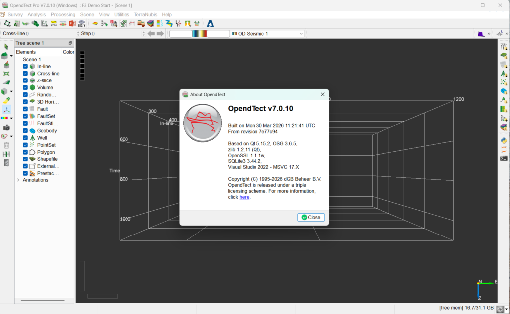
OpendTect, developed by dGB Earth Sciences, is an open-source seismic interpretation software designed for post-processing, visualizing, and interpreting multi-volume seismic data. This software suite plays a critical role in seismic data interpretation workflows within the oil and gas exploration industry. Developed by dGB Earth Sciences, OpendTect is utilized by petroleum engineers and geoscientists for transforming complex seismic datasets into actionable geological insights. A key differentiator is its hybrid open-source and closed-source (OpendTect Pro) model, offering a flexible platform for diverse project needs.
Introduction and Applications in Geosciences

Overview and Key Features

OpendTect is a comprehensive seismic interpretation software package that serves as a pivotal tool for geoscientists and petroleum engineers. Developed by dGB Earth Sciences, its design is rooted in providing sophisticated capabilities for processing, visualizing, and interpreting seismic data. The software is built upon an open-source foundation, ensuring accessibility for academic institutions and researchers, while also offering commercial extensions that provide advanced functionality for industry professionals. This dual approach allows for a broad spectrum of applications, from fundamental geological research to high-stakes oil and gas exploration projects.

Key features of OpendTect include its robust visualization tools, which are essential for understanding the subsurface geology from seismic reflection data. It supports the handling of multi-volume seismic datasets, enabling users to correlate different data types and gain a more complete picture of underground structures. Furthermore, OpendTect facilitates detailed geological modeling and analysis, supporting workflows that are critical in locating hydrocarbon reservoirs and understanding geological formations. The integration of machine learning capabilities also enhances its utility for advanced data analysis.

Seismic Data Processing and Visualization Tools

Handling Multi-volume Data

OpendTect excels in the processing and visualization of seismic data, particularly its ability to manage and interpret multi-volume datasets. This capability is crucial for modern geophysical data analysis, where multiple seismic surveys or different processing attributes need to be analyzed in conjunction. The software allows for the overlay and comparison of various seismic volumes, such as stacked seismic, velocity cubes, and inversion results, directly within its visualization environment.

Users can leverage OpendTect’s tools to enhance seismic data visualization through features like horizon and fault visualization, amplitude extractions, and attribute mapping. These tools are instrumental in identifying subtle geological structures and features that might be missed with simpler interpretation methods. The software’s adaptive rendering and interactive 3D seismic visualization enable geoscientists to explore complex subsurface geometries efficiently, leading to more accurate interpretations and informed decision-making in exploration projects.

Integration and Compatibility with Other Software

Seamless integration with existing industry workflows is a cornerstone of OpendTect’s design. The software supports a wide array of industry-standard data formats, ensuring compatibility with data acquired from various sources and processed by different software packages. This flexibility allows petroleum engineers and geoscientists to incorporate OpendTect into their established data pipelines without significant disruption.

Beyond data format compatibility, OpendTect offers integration capabilities through its plugin architecture. This allows for cooperative workflows with other specialized geoscience software. For instance, users can extend their analysis by exporting data or interpretations to other modeling or reservoir simulation tools. This interconnectedness enhances the overall efficiency of the exploration and production workflow, enabling a more holistic approach to subsurface analysis and geological modeling.

Commercial Extensions: OpendTect Pro and Plugins

While OpendTect provides a powerful open-source foundation, its commercial extensions, particularly OpendTect Pro and a variety of specialized plugins, significantly expand its capabilities for professional users. These extensions are designed to address the complex demands of the commercial oil and gas sector, offering advanced functionalities that complement the core software.

OpendTect Pro introduces enhanced features such as advanced well log management, sophisticated seismic inversion tools, and improved capabilities for handling large-scale seismic projects. The availability of numerous OpendTect plugins further customizes the software for specific tasks. These plugins can cover areas like structural uncertainty analysis, advanced fault interpretation, geostatistical modeling, and machine learning applications for seismic interpretation. This modular approach allows users to tailor the software to their precise project requirements, providing a flexible yet highly capable seismic interpretation solution.

Real-world Case Studies and Use Cases

OpendTect has been deployed across various real-world scenarios in the earth sciences, demonstrating its utility in both academic research and industrial exploration. In the oil and gas industry, petroleum engineers and geoscientists utilize OpendTect for identifying potential hydrocarbon reservoirs. This involves detailed interpretation of seismic attributes to map stratigraphic traps and structural features, such as faults and anticlines, which are critical indicators of potential oil and gas accumulation.

In geological research and academia, OpendTect serves as a valuable tool for education and scientific investigation. Students and researchers use the software to visualize and interpret seismic data from various geological settings, contributing to a deeper understanding of basin evolution, tectonic processes, and subsurface resource potential. Its open-source nature makes it an accessible platform for developing new methodologies in geophysical data analysis and geological modeling.

You must log in to submit a review.